Frankfurt may be known for its skyline and financial district, but step just outside the city and you'll find yourself in some of Germany's most rewarding hiking territory.
Four distinct natural areas surround the city, each with its own character and trails. Best of all, each can be reached by an easy journey from Frankfurt's main railway station.
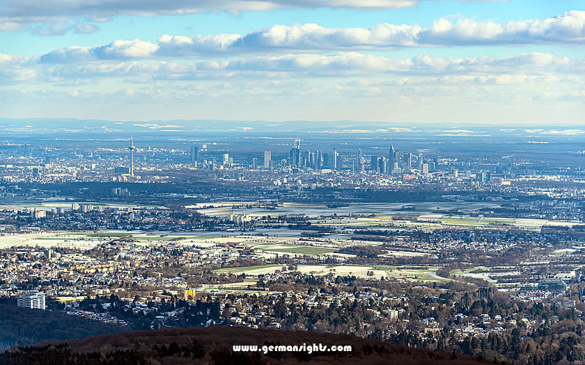
View of Frankfurt from the Taunus mountains
To the north rise the Taunus hills, whose forested peaks can be seen from the city centre on a clear day. To the east, the Spessart offers dense forests and hidden valleys.
The Odenwald forest stretches south-east, with its mix of woodland and traditional villages, while the Vogelsberg region to the north-east displays its volcanic heritage with rolling hills and distinctive rock formations.
German efficiency is reflected in the excellent public transport links to all these areas. Regular trains and buses run from Frankfurt to the main starting points, making day hikes easy to organise. You don't need a car to access hundreds of well-marked trails.
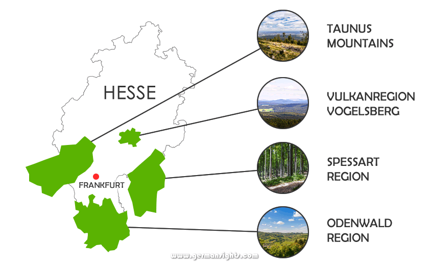
Four hiking areas around Frankfurt
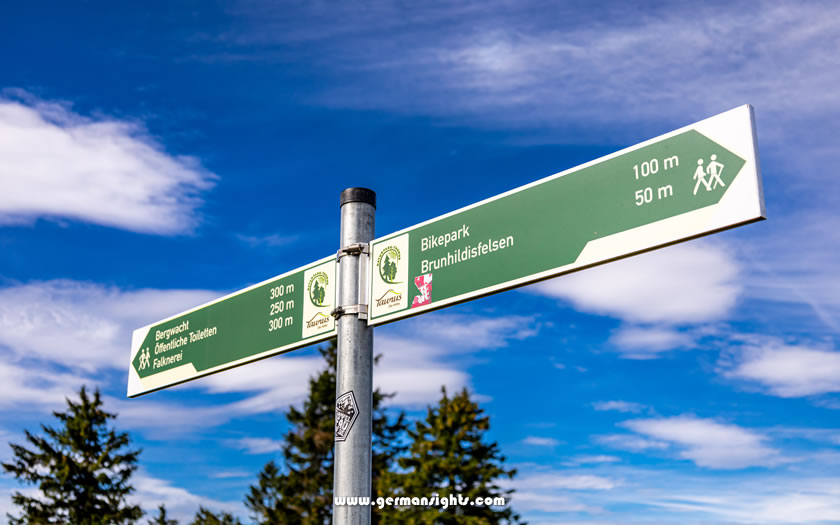
These areas cater for casual walkers and serious hikers alike. You'll find everything from easy two-hour loops to challenging day-long walks. All trails follow Germany's trusted signposting system and are maintained year-round by local hiking clubs.
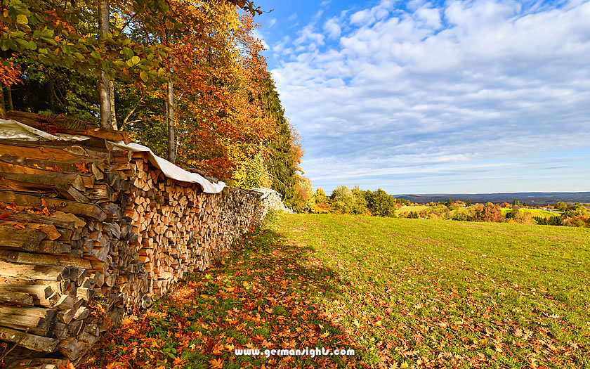
The Taunus Mountains form a green wall north of Frankfurt, with the highest peak, the Großer Feldberg, reaching 881 metres. Its transmitter tower can be seen from many parts of the city. This modest height makes the range perfect for day hikes, with trails that won't leave you gasping for breath.
Getting there is easy. Trains run every 30 minutes from Frankfurt to popular starting points such as Kronberg and Bad Homburg. These historic spa towns offer more than just access to the trails - they're worth exploring themselves. From either town, well-marked footpaths lead into the hills within minutes of leaving the station.
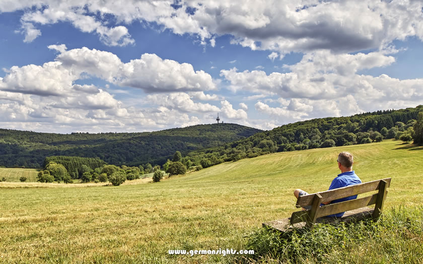
The Taunus mountains in Hesse
The main ridge trail, the Taunushöhenweg, runs for oveer 100 kilometres along the ridge. Don't feel like you have to do it all - the best day hikes are short sections.
A popular route starts at Königstein and climbs through beech woods to the ruins of Königstein Castle. From here you can see the Frankfurt skyline and, on a clear day, the Odenwald forest.
The terrain is more varied than you might expect. The eastern Taunus offers gentle slopes and wide paths, ideal for casual walkers or families.
The western sections are more challenging, with narrow paths and rocky sections that require proper walking boots.
History buffs will appreciate the Roman remains. The Saalburg, a reconstructed Roman fort, sits right on the old Limes frontier wall. Several trails pass by this UNESCO World Heritage site, making it an ideal lunch stop.
Check the weather before you go. The Taunus hills create their own microclimate, and clouds often gather when the sun is shining in Frankfurt. Even in summer, pack a light raincoat and water.
The good news is that if rain threatens, there is a good choice of mountain huts offering shelter and traditional German food.
The Spessart presents a different face to the Taunus.
Here, one of Germany's largest unbroken stretches of forest stretches across rolling hills, with patches of original ancient woodland still intact. These hills are crisscrossed by ancient trade routes once used by merchants and, more unpleasantly, bandits.
The Spessart is about 45 minutes by regional train from Frankfurt to Aschaffenburg, the gateway to the region. From there, local buses will take you to the starting points of the walks. Major starting points include Mespelbrunn, famous for its moated castle, and Bad Orb, a traditional spa town.
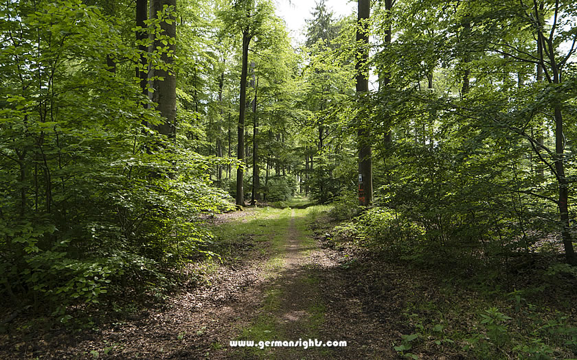
Hiking the Spessartweg trail
The trails here bear witness to the region's past. The Spessart was once Europe's centre of glass production and many trails follow the old glassmakers' routes.
The Eselsweg (donkey trail), a 111-kilometre former trading route, is one of the area's most historic trails. Day walkers often tackle the circular route from Mespelbrunn to Heimbuchenthal, a manageable 15km.
Unlike the Taunus, the Spessart offers mostly gentle terrain. Wide forest tracks alternate with narrow forest trails. The hills rarely exceed 500 metres in height, making walking here less demanding. Oak and beech trees dominate, providing dense shade in summer - perfect for walking on hot days.
Wildlife watching adds to the interest. The Spessart has healthy populations of deer and wild boar, although you'll need luck and soft footsteps to see them. Early morning or dusk walks offer the best chance of seeing wildlife.
The local infrastructure is well suited to walkers. Traditional forest inns appear at strategic points, serving regional specialities such as wild mushroom dishes and game. Many offer simple but comfortable rooms if you plan to extend your walk over several days.
Remember to pick up a trail map - the forest can be confusing for newcomers. The trails are well marked, but similar-looking sections of forest can confuse first-time visitors.
The tourist offices in Aschaffenburg or Bad Orb have reliable maps and can suggest routes to suit your ability.
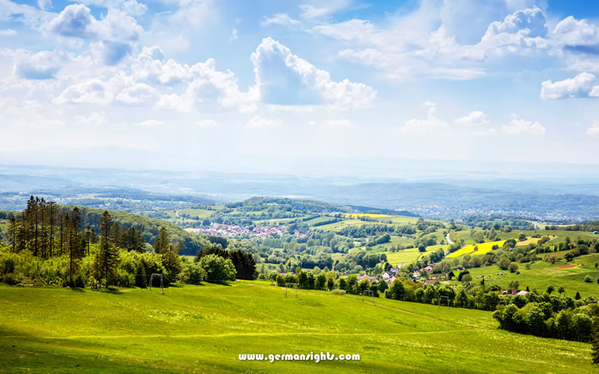
To the south-east of Frankfurt lies the Odenwald, a varied region where open meadows break up the forest cover.
This landscape has inspired legends, including parts of the Nibelungen saga. Today it offers some of the most varied walking in the region, with a mix of forest trails and village-to-village routes.
Trains from Frankfurt take 20 minutes to Darmstadt, your main gateway to the northern Odenwald. For the more scenic central region, continue on to Bensheim or Heppenheim. Both towns lie on the Bergstrasse, an ancient road that marks the western edge of the Odenwald.
Meadows and woods in the Odenwald region
The Nibelungen Trail is the most important trail in the region. Despite its name, this 130-kilometre route doesn't require heroic strength. It crosses the whole region, but can be done in day-long chunks. The section from Lindenfels to Bensheim is a perfect example - medieval castles, forest paths and valley views in a manageable 15km.
In contrast to the dense Spessart, the landscape of the Odenwald varies frequently. You'll walk through orchards, past granite outcrops and across open uplands. The hills reach heights of around 600 metres, providing good vantage points without strenuous ascents. The Felsberg, with its scattered granite boulders, is a distinctive landmark.
Small villages appear regularly on most routes, making the Odenwald ideal for less experienced walkers. You're never far from facilities, and local buses can take you back to train stations if necessary. Many villages have traditional wine taverns, which are open seasonally for walkers and locals.
There are trails for all levels. Family-friendly trails circle the Felsenmeer, a fascinating "sea of rocks" near Lautertal. More challenging routes take in the heights around Beerfelden, where old border paths follow the ridge lines.
Spring and autumn are the best times for walking in the Odenwald. Spring brings fruit tree blossom along the Bergstrasse, while autumn colours light up the forest. Summer works too, but the mixed landscape offers less shade than the Spessart. Winter walking is possible on the main paths, although smaller trails can get muddy.
Remember to carry water, although villages appear regularly. Local springs provide drinking water at marked points, continuing a tradition from medieval pilgrim routes. Look out for the "Trinkwasser" ('drinking water') signs near fountains and taps.
The Vogelsberg stands out from Frankfurt's other walking areas. It is the site of Europe's largest extinct volcano, with a distinctive landscape of rolling hills and basalt formations. Although its volcanic activity ceased millions of years ago, the rich soil and unique terrain provide excellent walking conditions.
The Vogelsberg area takes a little longer to get to than the other walking areas around Frankfurt. The connections with train and bus to small towns such as Schotten or Lauterbach take about two hours or more. This extra distance means fewer weekend crowds - a fair trade for the journey time.
View from the Hoherodskopf peak in the Vogelsberg region
The area's volcanic past is reflected in its circular shape and spoke-like trail system. Paths radiate out from the centre like spokes of a wheel, with connecting routes forming circles at different elevations. This layout allows for loop walks of varying lengths. The Vulkanring, a 125 kilometre circular trail, forms the outer rim of the wheel.
The terrain surprises most first-time visitors. You'll find gentle slopes and wide plateaus instead of steep peaks. The highest point, Taufstein, is only 773 metres. These modest heights create excellent walking conditions with open views over the surrounding countryside.
Wildlife watching is excellent here. The mixed landscape of grassland, woodland and wetlands supports a wide variety of species. Red kites soar overhead, while grazing areas are home to rare bird species. Dawn and dusk walks offer the best opportunities to see wildlife.
Local farmers maintain the traditional 'Hutewald' - wooded pastures where cattle still graze under scattered trees. These areas offer a glimpse of medieval farming practices and create unique walking environments. In spring these pastures are covered with wild flowers.
Weather conditions can change quickly in the Vogelsberg. The altitude and exposed position of the region means that clouds and wind are common. Pack an extra layer, even in summer.
The upside? When Frankfurt is sweltering in the summer heat, the Vogelsberg offers cooler walking conditions.
Several villages are good starting points for walks.
Herbstein, with its historic spa, offers comfortable accommodation and access to trails. Ulrichstein, the highest town in Hesse, offers dramatic views from its castle ruins. Both towns have tourist offices with up-to-date trail information and maps.
Remember to check bus times if you're not returning to your starting point. Buses run less frequently than in the Taunus or Spessart regions, especially at weekends. Some walkers arrange their routes so that they end at a different station, giving more flexibility with return times.
Each of the walking areas around Frankfurt offers something different.
The Taunus offers the easiest access and the most developed network of trails - perfect for first-time visitors or those with limited time. Its mix of challenging and easy trails caters for all levels of walker, while its mountain huts offer reliable rest stops.
The deep forests of the Spessart are ideal for those seeking a quiet nature experience. Its gentle terrain and historic trails are ideal for relaxed day walks. The area's traditional forest inns add a cultural dimension missing from more developed regions.
The Odenwald offers variety with its changing landscape and many villages. It is particularly suitable for walkers who enjoy combining natural and cultural experiences. Regular access to facilities makes it ideal for families or less confident walkers.
The Vogelsberg rewards those willing to travel a little further. Its unique volcanic landscape and low visitor numbers make for a more solitary walking experience. The region is ideal for walkers who enjoy open spaces and wildlife watching.
The walking season runs from spring to autumn, although each area has its own special time. Spring brings wildflowers to the slopes of the Taunus, summer offers shade in the Spessart forests, autumn colours light up the Odenwald and the Vogelsberg hills offer clear winter views on crisp days.
Some practical advice applies to all areas:
Keep in mind that German signposting, while reliable, may differ from that of other countries. Yellow or green signs usually indicate local trails, while red and blue indicate longer distance routes. Tourist offices in each region provide free basic maps and up-to-date trail conditions.
Trail markers in the Hochtaunus region
For emergency help, save 112 in your phone - it is the European emergency assistance number and works throughout Germany. Mobile phone coverage is generally good near towns and cities, but can be patchy in remote valleys.
These four regions offer enough variety for years of exploration. You could start with day hikes in the Taunus to familiarise yourself with Germany's network of footpaths, then move on to the other areas as your confidence grows.
Each region reveals new aspects of the landscape around Frankfurt, revealing that Germany's financial capital is at the heart of some remarkable walking country.
If you are more into sightseeing than hiking, or just feel like taking a rest from walking, then try our page about Day Trips from Frankfurt